Sunday 31 May 2026
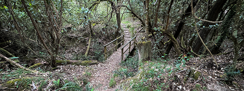
The running at Blackwood is beautiful… and features plenty of variety within each course. Starting at the picturesque recreation reserve, the courses follow predominantly single track that winds its way beside the Lerderderg River, along historic aqueduct trails cut in during the Gold Rush in the 1860’s and along verdant green valleys filled with life.
The Long course stands out from the crowd with a solid climb in the middle of the course, whilst the medium and short courses are quite flat and will make for some fun (and fast) running as you slalom between the eucalypts.
We’re excited for the new trails and can’t wait to show you!
The courses
Long course: 22km with 570m ascent
Medium course: 15.8km with 330m ascent
Short course: 7.9km with 190m ascent
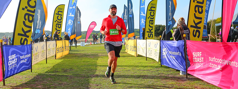
Finish Line Sprint
We will record and award a special Finish Line Sprint time for each runner as part of your overall race. The sprint will be over the last 100m – 200m leading into the finish line and allows you to show us how fast you can finish at the end of the race! It’s all in a bit of fun with fastest male and female sprinters will receive a prize thanks to our sponsors!
Course descriptions
Long course – 22km
Length: 22km. Elevation gain: 570m ascent Water Pts: 6.5km and 14.5km pts
Starting at the recreation reserve, runners commence going uphill on a 4WD track and around the edge of the Garden of St Erth native garden. From here there’s plenty of beautiful, flowing running on flat terrain beside the Lerderderg River and aqueduct trails. Things get serious again at the 7.5km pt as long course runners commence a solid climb for a couple of kms before a fast steep descend back to the aquaducts. From here on the course continues along long sections of single track, with a few smaller undulations before a fast downhill finish back to the Recreation Reserve.
Medium course – 15.8km
Length: 15.8km. Elevation gain: 330m ascent Water Pts: 5km and 8.3km pts
Medium course runners do a similar route to the Long but miss the large climb in the middle! Starting at the recreation reserve, you’ll commence going uphill on a 4WD track and around the edge of the Garden of St Erth native garden. From here there’s plenty of beautiful, flowing running on flat terrain beside the Lerderderg River and back along some weaving aqueduct trails cut in during the gold rush. Coming back past the Garden of St Erth, you’re following the Whipstick Trail through lush undergrowth and weaving gullies before a fast downhill finish back to the Recreation Reserve.
Short course – 7.9km
Length: 7.9km. Elevation gain: 190m ascent Water Pts: no water points on the short course
The Short course basically does the first 1km and last 7km of the long course (avoiding most of the hills!) Starting at the recreation reserve, you’ll commence going uphill on a 4WD track and around the edge of the Garden of St Erth native garden. From here short course runners turn left and follow the beautiful Whipstick Loop Trail as it descends through lush undergrowth and along a fun aqueduct trail along the valley. The trail weaves in and out of a few side gullies before a fast downhill finish back to the Recreation Reserve.
Finish Line Sprint
The Finish line Sprint will be a timed 100-200m segment leading into the finish line where we will record a separate time for each runner as part of your overall race. The course will curve around the recreation reserve and make for some fast and furious sprinting as you empty the tank into the finish line. We encourage everyone to have a crack and the fastest male and female sprinters will receive a prize thanks to our sponsors!
Passing etiquette
With a large number of runners a narrow trail there are a few points of common etiquette when it comes to passing a runner on the trail that we’d like all participants to be aware of. If you are a faster runner who wants to pass a slower runner on a narrow bit of track:
- Let the slower runner know you are there and want to pass. Say something like, “Can I go past when there’s a chance…” or even “Track please” if you’re short of breath. Then wait for a wider section of track – don’t just barge on through
- The slower runner can then say, “OK, go past on the right” or “just up here it’s a bit wider, go there”. But it’s good to acknowledge that you heard them and give direction for when they can go past
- It’s also nice for the faster runner to say, “thank you, keep going” once you’re past – share the love
- If you are going to pass then make sure you are actually faster, don’t pass if you are pushing 120% effort to get around them and then slow down afterwards
- Slower runners don’t feel like you need to totally stop and bow down as a faster runner comes through, make space but keep trotting along as well
Course marking
Trail running events are quite different to road running events in that they require you to look and think about where you are going because, not only will you pass through some lovely wilderness, but you need to KEEP AN EYE OUT FOR COURSE MARKINGS. Trail running courses are not lined with fences or red and white flagging tape and will not have marshals every 10m ready to hand you a drink and direct you where to go every step of the way – you need to keep an eye out for and follow the course markings to make your way around.
Having said that, if you have your head up and are looking where you are going the course will be easy to follow and will be marked as follows:
The Long Course:
- red and/or orange arrows (pegged into the ground and fixed to trees or bushes)
- fluoro pink coloured plastic surveyor’s tape (tied to trees or bushes)
The Medium Course:
- green arrows (pegged into the ground and fixed to trees or bushes)
- green coloured plastic surveyor’s tape (tied to trees or bushes)
The Short Course:
- blue arrows (pegged into the ground and fixed to trees or bushes)
- aqua blue coloured plastic surveyor’s tape (tied to trees or bushes)
All track intersections will be clearly marked and care should be taken to follow the arrows. Surveyor’s tape will be placed immediately following a track junction to confirm you are on the correct track. Track markings on the longer, straighter sections, where there are no other options or intersections will be far more spread out so take your time at the intersections to make sure you are on the right track. Unless otherwise marked or directed, competitors should follow the most major track at all intersections. If there is no arrow at a minor track junction then continue along the major track.